Map of Trieste from the Austrian Lloyd Guidebook
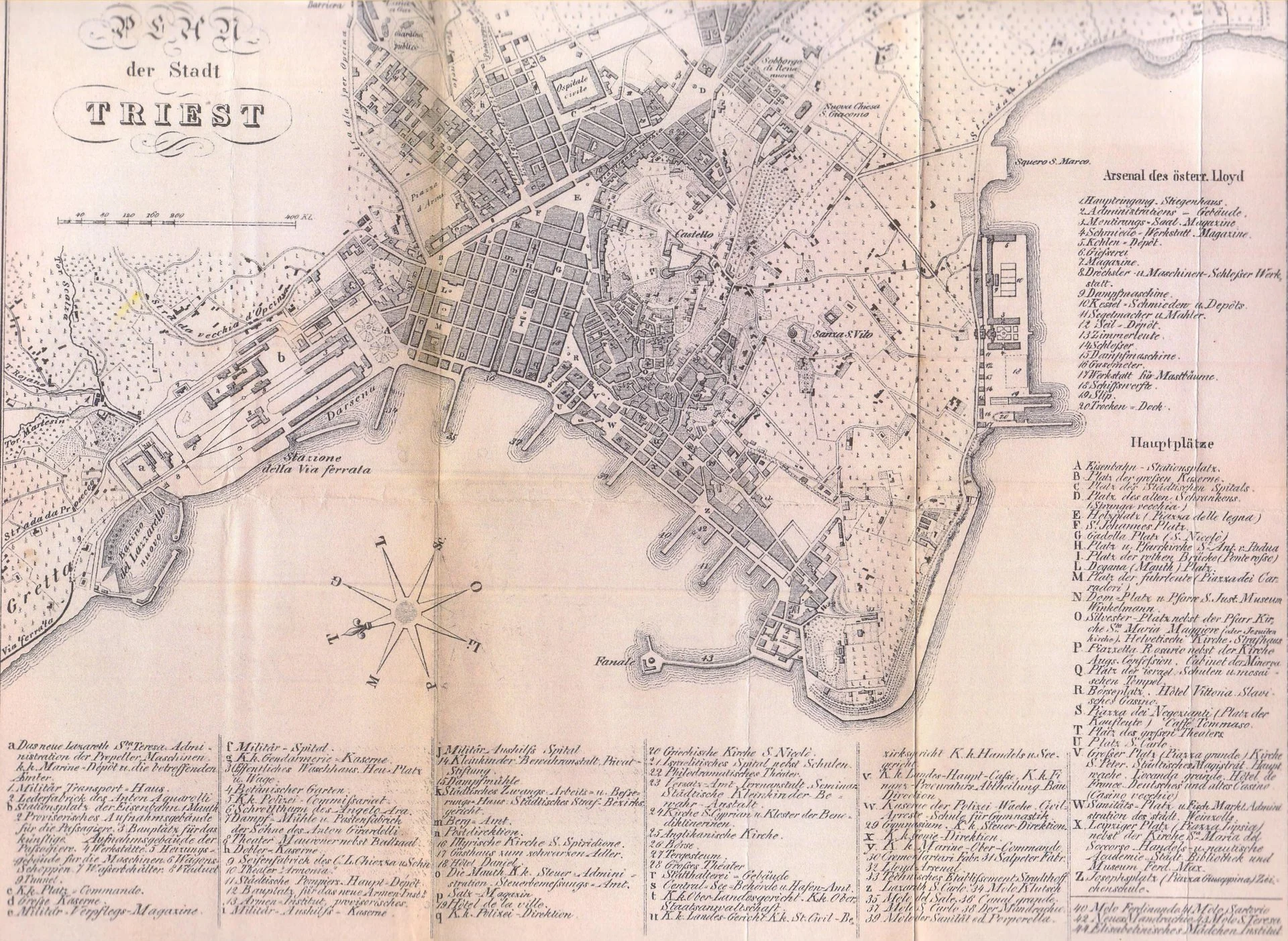
Map of the city of Trieste published in the Austrian Lloyd travel guide in 1857, the year the Southern Railway reached the city. The map documents the original elevated railway station ("Stazione della Via ferrata"), with the tracks arriving along the Gretta hillside, and the New Lazzaretto basin right beside it. A precious cartographic document: it shows the first railway alignment before the 1878 deviation that led to the construction of the present Central Station.
Year: 1857
Related Entities
Discover more photos
- Via Carducci nei primi decenni del secolo scorso
- Vista su Sant'Antonio Nuovo dal Colle di San Giusto
- Opicina - Obelisco
- Via delle Beccherie
- Riviera di Barcola
- Via del Molino a Vento
- Via dell'Istituto, oggi Pascoli, con la Pia Casa dei Poveri
- Scavi archeologici in Via del Trionfo nel 1913
- Sant'Antonio Nuovo
- Via Miramar
- Trieste Torre del Lloyd e Arsenale
- Vista sull'Arco di Riccardo