Historical Plan of Lazzaretto Santa Teresa in Trieste
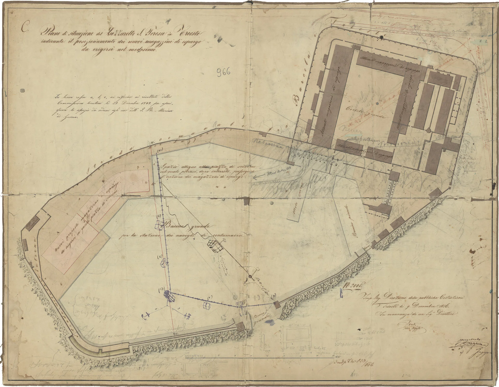
Detailed historical plan of the Lazzaretto San Teresa in Trieste, dating back to the mid-19th century. This cartographic document highlights the layout of the purge warehouses and the large basin dedicated to ships in quarantine, separated from the rest of the port waters. The map illustrates urban transformations related to the construction of the Southern Railway station and the covering of the Martesin stream. A valuable record of Habsburg port and sanitary engineering.
Related Entities
Discover more photos
- Via Carducci nei primi decenni del secolo scorso
- Vista su Sant'Antonio Nuovo dal Colle di San Giusto
- Opicina - Obelisco
- Via delle Beccherie
- Riviera di Barcola
- Via del Molino a Vento
- Via dell'Istituto, oggi Pascoli, con la Pia Casa dei Poveri
- Scavi archeologici in Via del Trionfo nel 1913
- Sant'Antonio Nuovo
- Via Miramar
- Trieste Torre del Lloyd e Arsenale
- Vista sull'Arco di Riccardo